


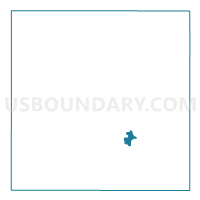
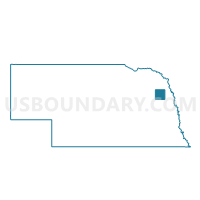
West Point Ward 3, Cuming County, Nebraska
About
Outline

Summary
| Unique Area Identifier | 612619 |
| Name | West Point Ward 3 |
| County | Cuming County |
| State | Nebraska |
| Area (square miles) | 1.34 |
| Land Area (square miles) | 1.33 |
| Water Area (square miles) | 0.01 |
| % of Land Area | 99.40 |
| % of Water Area | 0.60 |
| Latitude of the Internal Point | 41.84347300 |
| Longtitude of the Internal Point | -96.71240480 |
Maps

Graphs
Select a template below for downloading or customizing gragh for West Point Ward 3, Cuming County, Nebraska


Neighbors
Neighoring Voting District (by Name) Neighboring Voting District on the Map
- St. Charles Sherman Garfield & Cuming Precinct, Cuming County, NE
- West Point Ward 2, Cuming County, NE